Read the Transcript
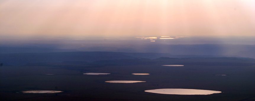
In the old days, some High Plains farmers referred to them as “buffalo wallows,” or “mud holes.” These days scientists call the shallow, ephemeral wetlands that dot the High Plains “playas,” and researchers are understanding more about them all the time. We say they’re ephemeral wetlands because they’re filled with water some of the time in good years of rain, and dry at other times. A layer of clay forms the bottom of the playa.
“The clay pan is the reason playas are functional.” That’s Barth Crouch, with Playa Lakes Joint Venture. “In the bottom of the playa basin, when it’s not wet, it dries out and opens up these large cracks that go down anywhere from inches to feet depending on how dry it is and how deep the clay pan is. Clay absorbs water and holds it, and when water runs into the playa, for the first day or two or three, before the clay swells shut, all that water goes straight down.”
“Now we’re starting to realize just how important these things are in terms of the groundwater connection.” That’s Bill Johnson, a University of Kansas geology professor, who says researchers from a number of disciplines are interested in playas. “They’re coming from all different directions. I think the one that’s really important now is what’s their connection with the groundwater?”
Here is another Bill Johnson. He’s a U.S. Fish and Wildlife Service biologist at Canyon Texas. “When that water is first flowing into a playa, although it takes a tremendously long time, some of that water is going to make its way down into the Ogallala Aquifer.”
There’s lot of new science on this — the idea that playas recharge the Ogallala Aquifer — and more specifically researchers are learning healthy, functioning playas provide the primary recharge. But, how do we measure this? When it comes to playas there are a lot of variables — including the amount of precipitation, and where that rainfall is happening on the landscape. Some playas won’t be wet for years. Others may hold water multiple times per year. Given these variables, how can we get a sense of the amount of recharge that can be generated by playas? I asked Barth Crouch for a simple example to a complex question. The state of Kansas has about 22,000 playa lakes. To even out some of those variables, we’ll assume all of those 22,000 playas had enough rain to fill the playa basin once in the year.
“If all of them were fully functional and recharging, on an annual basis they would provide about 6.6 billion gallons. To give you some idea of how much that is, this would be enough to recharge about 104 center pivot systems for one growing season for corn. Or if you’re in the town of Salina where I live, it’s about 50,000 people, it would be about three years of water for us. That brings it home.”
New Mexico Rancher John Wood has what might be the largest playa in New Mexico at 160 to 200 acres, on his land north of Clovis. He’s watched his playa closely over the years. “We can get a three-inch rain and the next morning it would be gone. It goes somewhere, and I think it goes down.”
Because playa lakes offer a clear path to recharge the dwindling water supply in the Ogallala Aquifer, it’s important that playas be healthy for the recharge mechanism to work. Contact your local USDA service center and ask how you can restore playas through the USDA Continuous Conservation Reserve Program or a Wetlands Reserve Easement.
Playa Country, which ended in late 2016, was a weekly show that featured conservation and wildlife experts — as well as farmers, ranchers and land managers — talking about conservation practices that improve wildlife habitat and landowners’ bottom-line. This episode was made possible by a grant from the Wildlife Conservation Society’s Climate Adaptation Fund, which was established by a grant from the Doris Duke Charitable Foundation.